FA
Today, Sunday، 22 Dec 2024 - 06:28
Mokhafaf

Acronym Finder

IfSAR
What is IfSAR ?
Interferometric Synthetic Aperture Radar
Interference of survey, radar, span a combination that interferes the feasibility of the radar aperture, synthetic and abbreviated InSAR or IfSAR, also called, a method of radar in the sciences of Geodesy and remote sensing is the use of interference spectroscopy, the phase of the waves sent and received to the levels, it is possible to create a model, the next level provides....
ASTER
What is ASTER ?
Advanced Spaceborne Thermal Emission and Reflection Radiometer
advanced reflection and the oncoming heat that briefly, Esther (ASTER) is called the ... sensor, and one of the five tools of remote sensing, mounted on the satellite Terra, which is in the year 1999 by NASA in the orbit of the Earth was. This sensored from February 2000 to collect data on the surface of the Earth is busy.


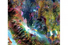
the image of Esther from the desert quadrant Saudi
Esther, satellite images of the earth with the power breakdown of the top and in the 14 band of the electromagnetic spectrum in the range of the visible spectrum, infrared heat to prepare. Resolution images ester from 15 to 90 km. The data Ester in the production of maps, detailed the temperature of the surface land. ., the reflection and the height of the sea level, goes to work.

models of the world digital elevation Esther (ASTER GDEM) for free to all users download....
SRTM
What is SRTM ?
Shuttle Radar Topography Mission
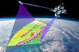
Mission, journalism Shuttle Radar briefly that SRTM is called for. research project Global for the preparation of the model, digital elevation, which is the range almost universal between circuits 56 degrees south and 60 degrees north to provide the most complete database of public journalism with high resolution. SRTM consists of radar modified special is that during the mission the 11-day STs-99 in February 2000 on the space shuttle spacecraft endeavour was installed.

model elevation for a mosaic set, each of which are one degree of longitude and one degree of latitude covers and to name the coordinates of the southwest corner of the It is called. For example, \"n45e006\" from the orbit of 45 degrees north and the meridian of 6 degrees east orbit 46 degrees north and the meridian of 7 degrees east. and \"s45w006\" from the orbit of 45 degrees south, and the Meridian 6 degrees west, the circuit 46 degrees south and the meridian of 7 degrees west and covers.

resolution raw data SRTM a second Arc (30 km), but access to the data with this accuracy only for the Federal Government of the United States of America possible. In November 2011 the data with the precision of a h arched for Australia also was provided, but the use of raw data in the monopoly of the state. Data SRTM for the rest of the world has the accuracy of 90 m (3 sec arc). Each mosaic data 30 yards has 3601 rows of data that each of the 3601 cell 16-bit . Elevation data SRTM-based system world of 1984 is calculated.

in September 2014, the White House announced that the highest precision data SRTM at the end of the year 2015 for all around the world, will be available, and now new data with the accuracy of 1 h, Arc (30 km) for all points covered by the project download is.

model elevation extracted from the data, SRTM data is in geographical information system goes to work. This model can be download from the internet. Format it (hgt.) That is a lot of software support.

The Mission of public journalism the Shuttle Radar project is an international by the National Agency for geographic information United States of America and NASA, driven....
OSTM
What is OSTM ?
Ocean Surface Topography Mission
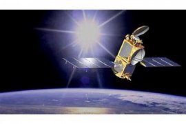
The mission of public journalism the surface of the ocean on the satellite Jason-2 that briefly (OSTM) is called, Project, satellite, international, scout the land, that from 1992 to steadily measure the height of the surface of the water, pays. The basis for this project by NASA and the National Center for Space Studies, began with the launch of the satellite, Jason-1 in 2001, continued.

satellite Jason-2 is Thales MySpace made in June 2008 with the use of rockets, the Delta 2 from the Air Force Base in California was launched....
ABA
What is ABA ?
Abscisic Acid
acid (Abscisic acid) is a hormone important plant with the ID of the pub, 5280896. Appearance of this composition, the crystals colorless. This in inhibitory the growth of plants is effective. Acid (ABA) of other inhibitors natural herbs about one hundred times stronger and processes, such as recession, Acorns, etc., the buds and also the loss of limbs, control....
RCPSP
What is RCPSP ?
Resource Constraint Project Scheduling Problem
The issue of project planning with resource constraints
or
the limitation of resources issue of project planning...
BTPPC
What is BTPPC ?
Benzyl Triphenyl Phos Phonium Chloride
Stands for the chemical composition of the synthesized were...
IR
What is IR ?
Integrated Reporting
Reporting integration

in the sphere of accounting and management raised....